Margherita Peak is Africa’s third highest peak, however the real beauty is in the climb up the Kilembe route where the forest flora is diverse and the valleys a mass of ferns. The trees are alive with many species of birds and primates and, as you walk up the trail, you will see chimp nests high up in the tall trees. If you are lucky, you may catch a glimpse of the resident chimpanzee as they scamper away. Climbing Margherita Peak is more of a hard scramble than a climb, except for a few difficult moves and when it snows it is more difficult. However, the reward and exhilaration of reaching the top is enormous as you look across Albert Peak to the DRC (Congo) then east across the spectra of the Rwenzori Mountains.
Rwenzori Hiking
Conquer the Mountains of the Moon
Destination
Rwenzori
Base Price
From $3534 Per person
Trip Duration
8
Days
Trip Overview
Highlight Experiences

Cultural Connection with Bukonzo Heritage
Learn about the sacred relationship between the Rwenzori Mountains and the Bukonzo people, including their cultural emblems and traditional reverence for these mystical peaks under their King Omusinga.

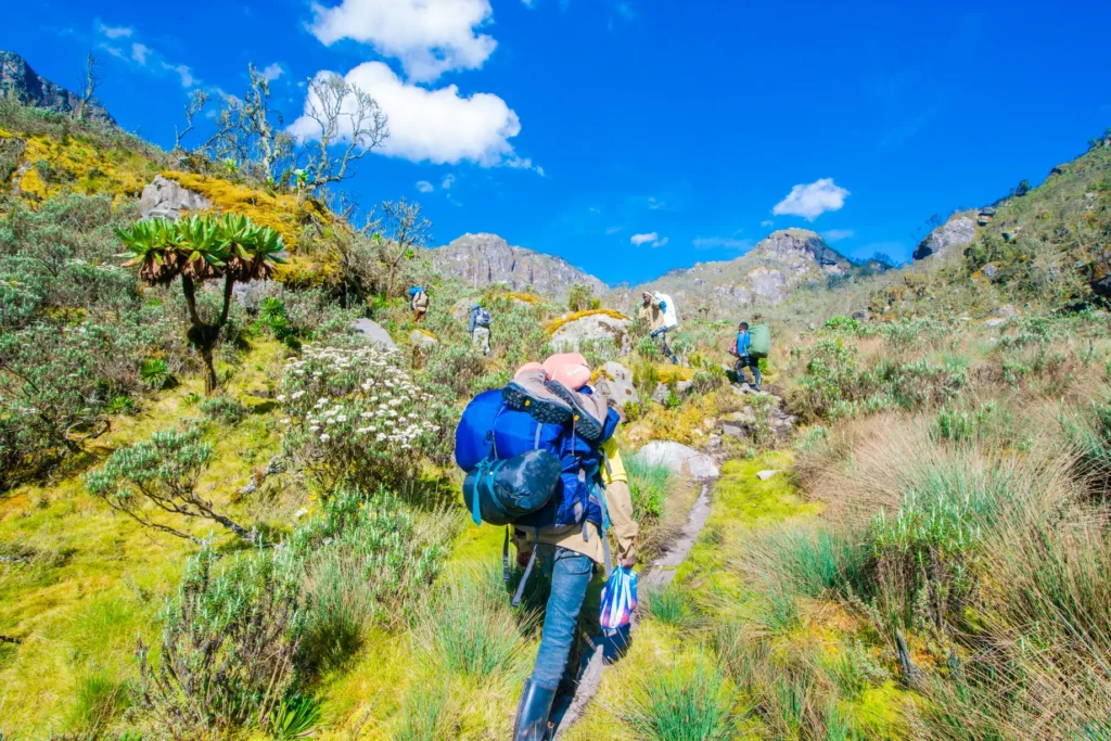
Diverse Ecosystem Exploration
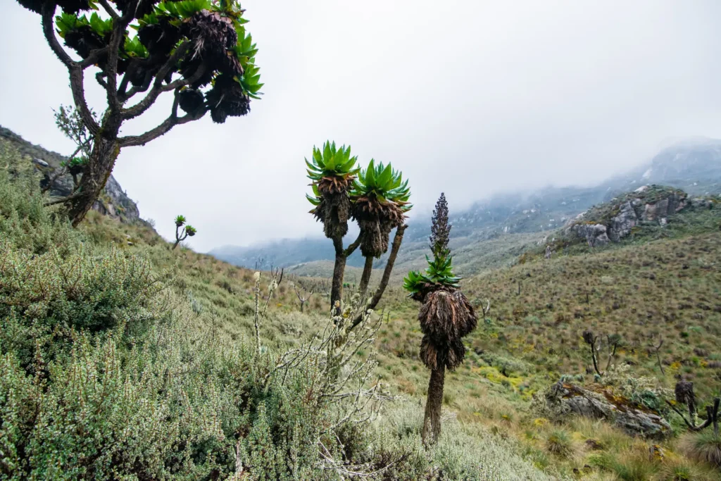
Journey through five distinct vegetation zones from Afro-montane forest to alpine desert, encountering blue monkeys, colobus monkeys, rare L'Hoest monkeys, and possibly wild chimpanzees.

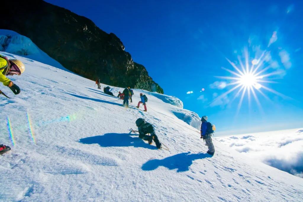
Glacial Adventure & Mountain Views
Experience equatorial glaciers on Stanley Glacier, cross high-altitude passes like Scott Elliott's and Oliver's Pass, and enjoy panoramic views across the Congo rainforests and Uganda's national parks.

Mystical "Mountains of the Moon" Experience
Trek through the legendary Rwenzori range with its otherworldly Afro-alpine vegetation, giant lobelias, groundsels, and moss-covered landscapes shrouded in mist and ancient mystery.

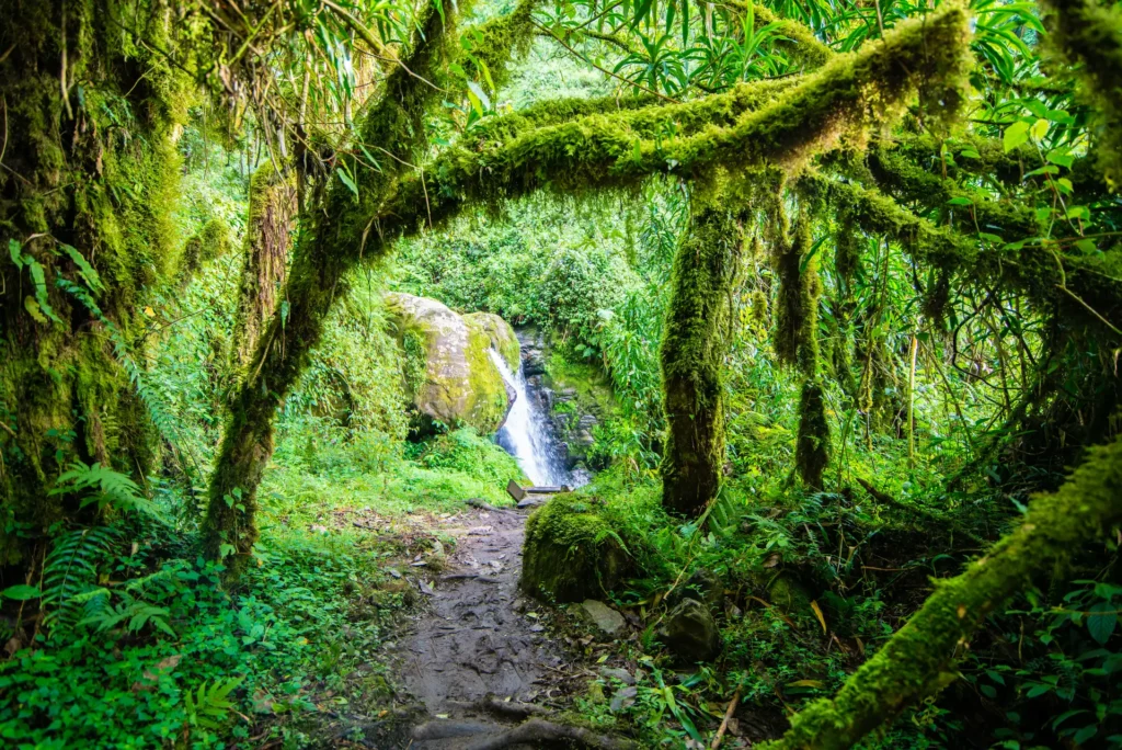
Stunning High-Altitude Lakes & Waterfalls
Discover pristine alpine Lake Kitendara, spectacular Enock's Falls, countless cascading waterfalls, and the breathtaking Nyamwamba Valley with its moss-covered rocks and deep gorges.

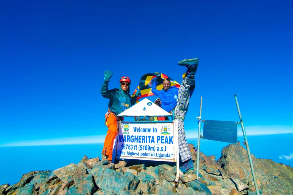
Summit Africa's Third Highest Peak
Challenge yourself to reach Margherita Peak at 5,109 meters on Mount Stanley, following the historic route of the Duke of Abruzzi from 1906 while navigating glaciers and alpine terrain.
Wildlife
Mountain hiking and climbing
- 5 star executive suite
- English and local language
- Vegeterian, Non Vegeterian and Vegan
- Hotel Accomodation in Paris Hotels
- Suitable throughout the year
- Available
Clients Testimonials
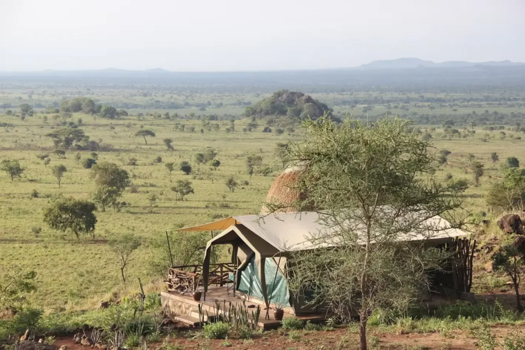
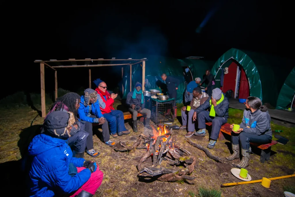
What's Included
- 4WD custom-built safari vehicle and fuel
- Accommodation
- Airport transfers
- AMREF Flying Doctor Service
- Equipment for the climb (crampons, ropes harness, carabiners)
- Meals during the Rwenzori trek and otherwise as per your chosen plan
- Park entrance fees
- Porters for the trekking trip
- Professional, English-speaking guide
- Rwenzori Hiking fees
What's Not included
- International flights
- Visa fees
- Travel insurance
- Personal expenses
- Laundry services
- Gratuities/tips
- Optional activities not specified in the itinerary
Pricing
People | USD | Room |
---|---|---|
4 People | $3727 per person |
2 Double |
6 People | $3534 per person |
3 Double |
2 People | $4308 per person |
1 Double |
Location Map
Itinerary
Start at Trekkers at 1,450 meters and sleep at Sine Hut at 2,596 meters being a height gain of 1,146 meters, or those who are fit and want to proceed to Kalalama Camp at 3,134 metres may do so and apart from the fantastic views gives you more time at Mutinda Camp where you may climb up to Mutinda Lookout at 3,975 metres.
We start by walking up the valley floor through tall forest trees of the Afro Montane Forest Zone. This is a steady climb with multitudes of birds and a chance of seeing blue monkeys scampering off through the forest. At times visitors may see troupes of 15 to 20 black and white Colobus monkeys as they swing through the tree tops. There are rare sightings of the L’Hoest monkey which are part of the Bukonzo cultural emblems and are protected by the virtue of the King or Omusinga or you may hear wild chimpanzee in the distance. There is wide variety of plant species from forest trees to bamboos thickets, low shrubs, flowers, fungi, and with many moss and lichen covered vines hanging from the tall trees creating an awesome appeal. Enock’s Falls are just 200 meters from Sine Hut and offer a splendid opportunity to capture a great screensaver for your memories.
At Sine Camp 2,596 metres we have wooden huts set between tall forest trees on a narrow ridge where you may sit and enjoy the beauty of the Afro Montane forest while you look down at a fantastic waterfall crashing over the rocks far below. Some clients prefer to sit outside enjoying the warmth of the campfire and chat to the guides about the mountains and life in their community. Sine is just below the bamboo zone and the area around has many different bird species. 150 meters from the camp is Enock falls which is set in livid green vegetation and hanging vine. Truly beautiful. Sleep at Sine, or those who are fit and want to proceed to Kalalama Camp at 3,134 metres may do so and apart from the fantastic views gives you more time at Mutinda Camp where you may climb up to Mutinda Lookout at 3,975 metres.
Day 2 :
Hiking!
Trekking starts at 8.30am and almost immediately you enter the Bamboo-Mimulopsis Zone which is steep climb with many high steps. In the wet season the bamboo zone is rather muddy and slippery making the going slow. However the atmosphere and the forest is beautiful as you climb 551 metres altitude and a distance of 1.8km to Kalalama Camp at 3,147 meters which is in the Heather-Rapanea Zone where you can take a rest and a quick cup of tea or coffee before heading on to Mutinda Camp. The trail meanders up and over several small knolls along a ridge top then drops down the side of the valley before climbing again, and in doing so cross several small streams and pass close to moss covered waterfalls. You then climb steadily along the side of a beautiful mossy river which tumbles down over the rocks under the Giant Heather trees whose trunks are covered in green moss with old man beards (Usnea lichen) hanging from the branches. The trail twists and turns as you climb up the deep valley, which has an enormous variety of plants and flowers. This valley is unique with many Giant Heather trees creating a beautiful atmosphere often shrouded in mist.
In the afternoon you may wish to climb up to the top of the Mutinda Lookout (one to two hours up and one hour down) The views are amazing as you stand on moss covered rocks at 3,925 meters with views across the Rwenzori Mountains and down to Kasese town and Lake George. For those clients who are climbing to Margherita or any of the main peaks climbing Mutinda 3,975 meters is also an excellent way to acclimatise and reduce the risk of high altitude sickness
Sleep at Mutinda Camp at 3.582 metres
Day 3 :
Hiking!
The trail to Bugata Camp is boggy particularly in the wet season but with a little skill you can step from tussock to tussock to make the going easier. First you cross the Mutinda valley through the tussock grass and everlasting flowers interspersed with many Giant Lobelias before climbing a steep section up to the Namusangi Valley (3,840 meters), with sheer waterfalls and looking back you get fantastic views of Mutinda Peaks. The Namusangi Valley is wide, with many ups and downs as the trail climbs steadily to Bugata Camp at 4,100 metres.
Day 4 :
Hiking
Trek to Hunwick’s Camp via Bamwanjarra Pass. As you leave Bugata Camp you pass up a ridge then drop down slightly before ascending to Bamwanjarra Pass at 4,450 meters where we have a hut should the weather turn bad. From the pass on a clear day you get excellent views of the three main peaks. The trail passes down the valley and around the edge of some bogs and thick ever green vegetation, moss. Giant groundsel and lobelia. Here is possibly the best place in all the Rwenzori to observe the Malachite Sunbird as it feeds on the many lobelia flowers and a known breeding site. Farther on there is some steep sections before a steady climb up and over a ridge to Hunwick’s Camp which is situated on the top of a deep valley and has good views of Mt Stanley, Mt Baker, Weismanns Peak and McConnell’s Prong.
Day 5 :
Hiking
From Hunwick’s we pass down and across the valley floor to Lake Kitendara which is very stunning with deep water and beautiful vegetation. From here you climb up Scott Elliott’s pass then up the ridge to Margherita Camp 4,485 metres which is situated between some huge rocks and offering some shelter from the strong winds. This is the very spot where the Duke of Abruzzi camped when making his climb to Margherita Peak in 1906.
Day 6 :
Hiking
Wake up at 2am and catch an early breakfast before heading off to climb Mt Stanley at 2.30am. This is necessary as the weather has changed a lot and often even during the dryer season the mountain is closed in with heavy clouds and snow falls from 1 pm to 4pm and this happens within a short period of 10 to 15 minutes as the clouds rise up from the extensive Congo rainforests. During January and February 2017 clients were closed in and unable to walk during heavy snow storms which previously were not heard of during the dryer season and arrived back at Margherita camp well after dark with one group arriving back at 11pm totally exhausted.
Due to this change in weather we have set a strict turnaround time of 10am so if you do not reach the peak before then you must turn around regardless of the disappointment in the interests of safety. Margherita glacier has also suffered with global warming and as the outer edges of the glacier recede the ice is becoming steeper with one section of about 200 meters more than 60% grade. Combined with this much of the blacker has melted underneath causing caves under the ice and as it get thinner eventually caves in. So is necessary that clients understand and take advice of where the guides suggest to pass.
For those clients with less mountaineering experience we suggest that you stay on Stanley glacier and climb up to a good vantage point on a rocky outcrop on the southern edge of Alexandra Peak to enjoy fantastic views over Congo and the lower mountain ridges
After ascending the peak at 5,109 metres you then pass directly down to Hunwick’s Camp at 3.874 metres.
Day 7 :
Hiking
Distance to Kiharo Camp 11km Time taken to walk 4 to 7 hours
From Hunwick’s Camp we start the day by climbing up a ridge towards McConnell’s Prong where you get the best views of all three peaks and Scott Elliott’s Pass before reaching Oliver’s Pass at 4,505 metres. The distance from Hunwick’s Camp to the top of Olivers Pass is 3km The trail then cuts across below Weismann’s Peak to the confluence of the Nyamwamba River which flows down thought Kilembe and Kasese to Lake George in Queen Elisabeth National Park.
If you wish to climb Weismanns Peak 4,620 metres from Olivers pass you may do so at an extra cost of $20 each. On a clear day you get fantastic views of Margherita and Mt Stanley, Mt Speke and Mt Baker.
After crossing the confluence the trail meanders down the valley to Kiharo Camp at which is situated in a deep valley with high cliffs and dense vegetation. On the way down the valley after each bog you will climb over a ridge of stones and earth which seems out of place but actually was pushed there by slow moving glaciers which eventually stopped moving, melted and left a pile of rocks and debris in front of where the glacier once stood.
Day 8 :
Hiking
Distance Kiharo Camp to the park gate 16km and another 2.8km down to Trekkers Hostel. Time to walk 5 to 8 hours so those who need to connect to flights back to Kampala or travel on to other activities need to leave Kiharo early.
The trail down the Nyamwamba Valley is mostly downhill and absolutely stunning with beautiful views, moss covered rocks along the river, cascading waterfalls, deep valleys and forests are possibly the best in the Rwenzori Mountains. This part of the trail took us six years to find a way through and a route which is easy enough for tourists to use. In 1937 the explorer and geologist McConnell tried to find a way up this valley but failed and have to turn back and search for another route up the mountain but now you can experience this truly beautiful valley.
A few kilometers from Kiharo Camp the path turns off to the right to pass along the river. In the clear areas you may catch a glimpse of a Duiker quietly feeding in small clearings as you pass along the river. This area is possible the highest population of Rwenzori Red Duikers anywhere in the National Park. A few kilometers down the river it becomes steeper with multitudes of stunning waterfalls. After the waterfalls we climb up and over a high ridge then down though the dense forests with stunning views of the valley below. We stop at Forest View Camp for lunch before proceeding back to Base Camp. A great experience and ending to a fantastic trek.
Accommodations
Take a look at some of the beautiful places you’ll be staying at during your trip.

Camping
Frequently Asked Questions – Rwenzori Hiking
What is the Rwenzori Mountains Trek and how challenging is it?
This 8-day trek takes you deep into Uganda’s Rwenzori Mountains — often called the “Mountains of the Moon.” It’s a physically demanding route that includes steep climbs, high-altitude passes, and rugged terrain, reaching altitudes above 4,500 meters. It's best suited for fit, experienced hikers seeking a true mountain expedition.
What is the highest point reached on this trek?
The trek reaches Margherita Peak, the highest summit in the Rwenzori range at 5,109 meters (16,763 ft), located on Mount Stanley. This is Africa’s third-highest mountain, and summiting it is a technical challenge requiring an early alpine start, crampons, and ice axes.
What kind of accommodation is used on the trek?
Accommodations are mountain campsites, with all nights spent in tents. The experience is rustic and immersive, surrounded by alpine vegetation, glacial lakes, and dramatic landscapes unique to the Rwenzori range.
What wildlife or nature can I expect to see during the trek?
The trek traverses lush forests, bamboo zones, giant lobelia-strewn valleys, and glacier-sculpted highlands. While the focus is on trekking, you may encounter endemic bird species, chameleons, and unique high-altitude flora — all within Rwenzori Mountains National Park, a UNESCO World Heritage Site.
What should I pack for the Rwenzori Mountains trek?
Essential gear includes sturdy hiking boots, waterproof layers, cold-weather clothing, sleeping gear for sub-zero temps, and technical gear for the summit day (ice axe, harness, crampons — typically provided or available for rent). A full kit list and porter support are usually arranged by the tour provider.
Have questions about this itinerary? We’re here to help.
All of our itineraries can be adapted to suit your personal interests and preferences. Please feel free to discuss these with us so we can personalize your tour for your maximum enjoyment.
